 Nila Kartika Wati
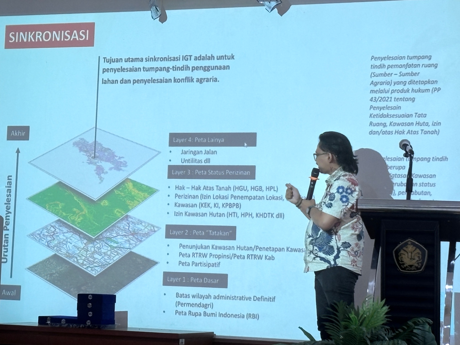
The launch of the 2026 National Data on Indigenous Peoples and Local Communities Conserved Areas and Territories (ICCAs) at the Faculty of Law, Universitas Pancasila, in South Jakarta on Friday, June 5, 2026, has brought the long-standing friction between state-led conservation and indigenous living spaces into sharp focus. For decades, the Indonesian government’s approach to environmental protection has frequently collided with the ancestral domains of indigenous communities, who view their territories not as mere administrative zones, but as intricate "networks of life" comprising homes, gardens, water sources, forests, ritual sites, and ancestral social relations. This discrepancy in spatial perception remains a primary driver of land conflict in the archipelago, as state-imposed boundaries often overlook the generational ties and traditional ecological knowledge that have preserved these landscapes for centuries.
Geger Rianto, a social anthropology academic from the University of Indonesia, emphasized during the event that the fundamental issue in Indonesia’s natural resource management is this divergent worldview. While the state perceives space through the lens of administrative lines on a map, indigenous peoples understand it as a living fabric. This fabric is woven from the relationships between humans, rivers, mountains, and the spiritual world. Rianto noted that in many instances, indigenous communities only become aware of official state maps when they are suddenly barred from accessing their own gardens or when their ancestral lands are unilaterally reclassified as protected zones. This "top-down" cartography creates a rift where the very people who have historically guarded the environment are the first to suffer from the restriction of their living space.
The Cartographic Conflict: Administrative Lines vs. Lived Reality
The tension between state-led conservation and indigenous rights is rooted in the way space is defined and governed. State conservation often follows a "fortress conservation" model, which seeks to protect biodiversity by isolating nature from human intervention. However, for indigenous peoples, the separation of humans from nature is an alien concept. Their "space" is a functional network that facilitates survival, culture, and spirituality. When the state establishes a national park or a protected forest, it often does so without consulting the communities already residing there, leading to what activists call "green grabbing"—the appropriation of land for environmental purposes at the expense of local livelihoods.
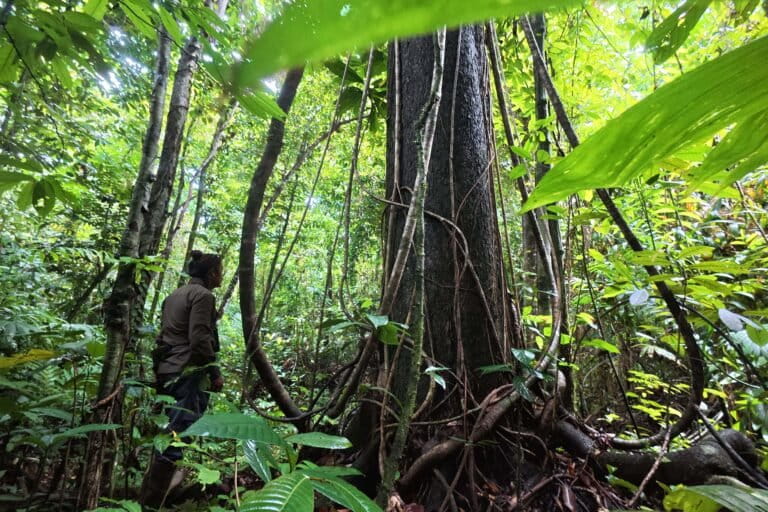
According to Rianto, the movement for participatory mapping, led by organizations like the Participatory Mapping Network (JKPP), is crucial because it shifts the role of indigenous communities from passive objects of state policy to active subjects of their own destiny. By documenting their own territories—including water sources, hunting grounds, and ritual sites—communities can present a counter-narrative to the rigid, often inaccurate boundaries drawn by central government agencies. These community-led maps serve as a tool for negotiation, demanding that the state recognize the "invisible" networks of life that exist beneath the layers of administrative data.
Quantifying the Overlap: 5.2 Million Hectares at Stake
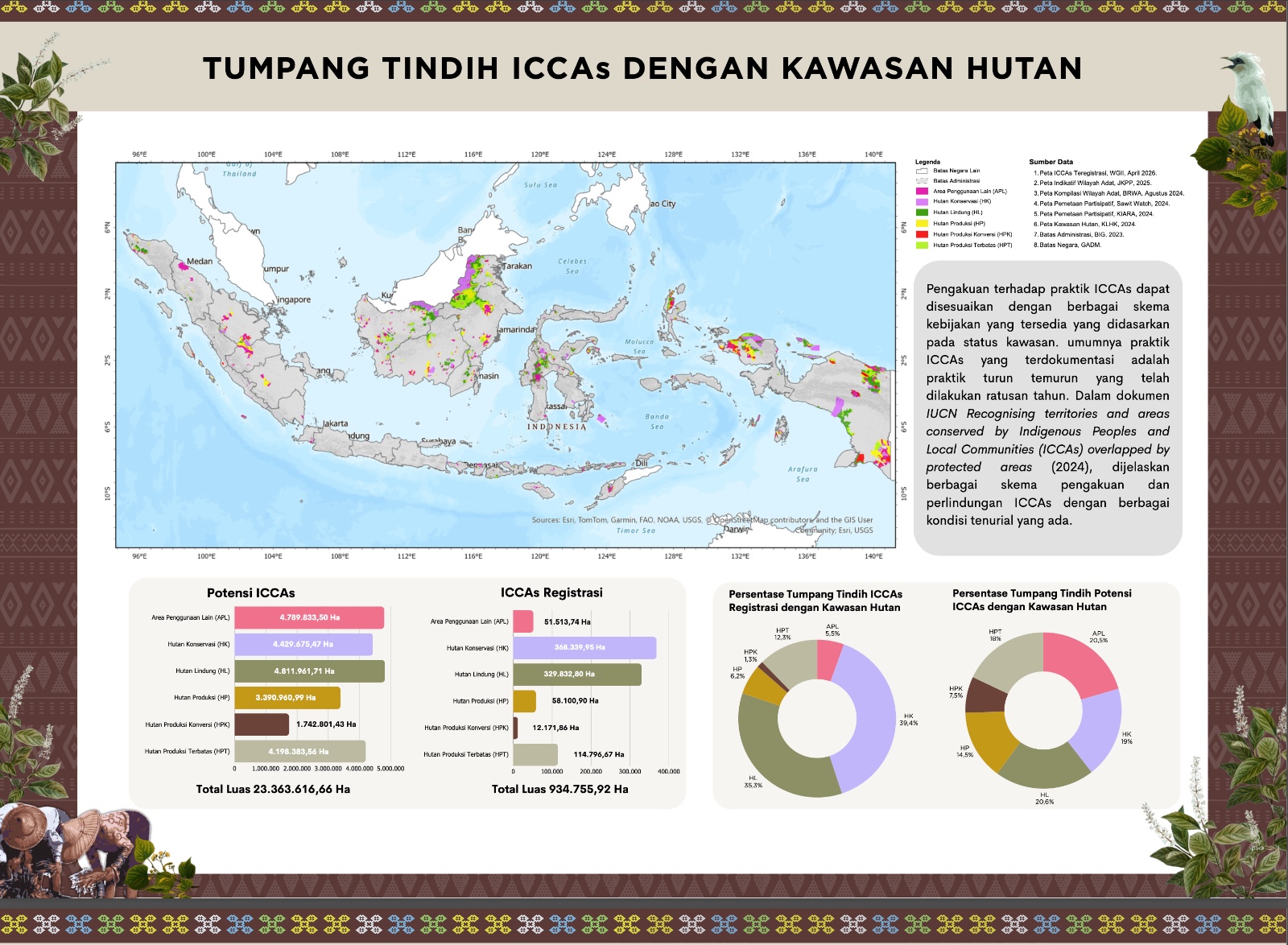
The scale of the conflict is underscored by staggering data presented by Imam Mas’ud, Head of the Advocacy and Campaign Division at JKPP. Based on the latest analysis, at least 5.2 million hectares of indigenous and community-managed territories overlap with state-designated conservation areas. The most significant friction occurs within National Parks, where approximately 3.5 million hectares of ancestral land have been absorbed into state jurisdiction. This overlap is not merely a statistical error; it represents a direct threat to the identity and survival of hundreds of communities across the Indonesian archipelago.
Mas’ud argued that when a community’s territory is restricted or seized in the name of conservation, the loss extends far beyond the physical land. The community loses its identity, its traditional pharmacy (the forest), and its historical continuity. For indigenous peoples, the land is a repository of stories and laws. Removing them from this land effectively erases their culture. The JKPP’s data suggests that the state’s centralized and exclusive approach to conservation is counterproductive, often leading to horizontal and vertical conflicts that undermine the very environmental goals the state claims to pursue.
Government Perspectives: Between Recognition and Regulation
Despite the clear evidence of overlap and conflict, the path toward formal recognition remains convoluted. Tely Dasaluti, Chairperson of the Working Team for Indigenous and Local Communities at the Ministry of Marine Affairs and Fisheries (KKP), acknowledged that the recognition of indigenous communities is not a "gift" from the state. Rather, it is a legal acknowledgment of a de facto reality that has existed long before the modern Indonesian state was formed. Dasaluti emphasized that sovereignty resides not just in the physical space, but in the local wisdom and traditional practices that govern it.
In coastal areas, for instance, traditional management systems like "Sasi" in Maluku and Papua have successfully regulated fisheries for generations. These systems dictate when and where people can fish, ensuring that marine resources are not depleted. Dasaluti noted that the KKP is pushing for local regulations (Perda) that recognize not only the communities themselves but also their specific traditional practices. However, she admitted that a significant hurdle remains: many local government heads do not prioritize indigenous rights, leading to a patchwork of recognition that varies wildly from one region to another. The acceleration of these recognitions requires a multi-stakeholder collaboration involving the government, civil society, and academia.
Similarly, Setyo Anggraini from the Ministry of Agrarian Affairs and Spatial Planning/National Land Agency (ATR/BPN) stated that securing indigenous land rights involves more than just issuing certificates. Evaluating the first indigenous land management rights (HPL) in West Java revealed that protection must be comprehensive. It must safeguard ritual sites, protect water sources from pollution, and mitigate disaster risks for settlements. Anggraini argued that land protection for indigenous peoples must be integrated with broader spatial planning, cultural preservation, and economic empowerment to ensure that future generations can continue to inhabit their ancestral domains.
The Legislative Stagnation: A Decade of Delay
While various ministries express support for indigenous rights, the overarching legal framework remains weak. Erasmus Cahyadi, Deputy Secretary General of the Alliance of Indigenous Peoples of the Archipelago (AMAN), highlighted the grim reality that the Indigenous Peoples Bill (RUU Masyarakat Adat) has been stalled in the Indonesian parliament for over 16 years. Despite numerous court rulings—most notably the 2013 Constitutional Court Decision (MK 35), which ruled that customary forests are not state forests—the legislative branch has failed to pass a comprehensive law that would provide a clear mechanism for recognizing indigenous territories.
In the absence of this law, the state continues to prioritize large-scale development projects and resource extraction. Cahyadi pointed out that conservation, when stripped of its social justice component, becomes just another instrument of displacement. He argued that the current debate should not be about whether indigenous peoples can protect nature—their track record over centuries proves they can—but whether the state is willing to see their living spaces as something more than lines on a map.
Analysis of Implications: Conservation as a Social Contract
The findings of the 2026 ICCA National Data launch suggest that Indonesia is at a crossroads. The global "30 by 30" initiative, which aims to protect 30% of the world’s land and oceans by 2030, provides a framework for conservation, but its implementation in Indonesia risks exacerbating human rights violations if indigenous territories are not central to the strategy.
The implications of continued state-indigenous conflict are twofold. First, there is the risk of "conservation failure." When local communities are excluded from conservation areas, they often lose the incentive to protect those areas, leading to increased illegal logging or poaching by outside actors who take advantage of the vacuum of local authority. Conversely, when indigenous rights are recognized, these communities become the most effective and low-cost guardians of biodiversity.
Second, there is the legal and social risk of ongoing land disputes. As Indonesia seeks to attract international green financing and carbon credit investments, the "clarity of tenure" becomes a critical issue. Investors are increasingly wary of projects embroiled in land conflicts. Without the passage of the Indigenous Peoples Bill and the harmonization of state maps with participatory community maps, Indonesia’s conservation efforts will remain legally fragile and socially contentious.
The 2026 ICCA data serves as a call to action. It demands a shift from "exclusive conservation" to "inclusive conservation," where the state recognizes that the best way to protect the environment is to protect the rights of the people who have lived in harmony with it for millennia. As the event concluded, the consensus among activists and academics was clear: the struggle for indigenous rights is not just about land—it is about the right to exist within a network of life that the state’s administrative maps have yet to fully comprehend.