 Nila Kartika Wati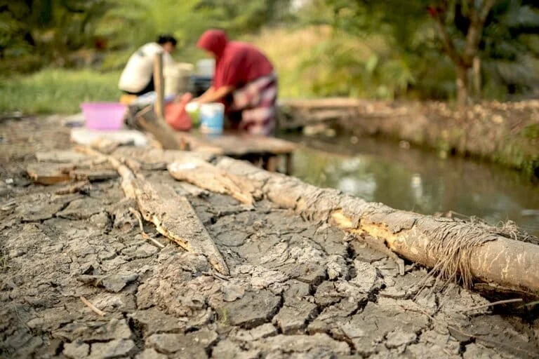
The prolonged dry season has descended upon the Bangka Belitung Islands with devastating intensity, leaving 13 villages and one sub-district grappling with a severe shortage of clean water. As reservoir levels plummet and groundwater sources fail, the fundamental right to water has become a daily struggle for thousands of residents. This hydrological crisis, now entrenched across the region, is not merely a product of shifting weather patterns but the culmination of years of environmental degradation, land-use transformation, and structural geological vulnerabilities that have left the island’s water table increasingly fragile.
The Human Cost of Water Scarcity
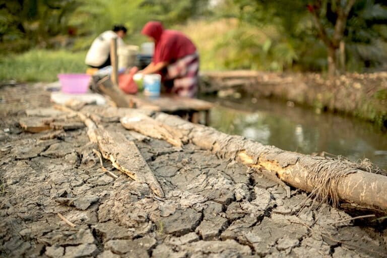
For the residents of Desa Zed in the Mendo Barat district, the current water emergency has reached a critical tipping point. The community’s primary water source, the Pamsimas (Community-Based Drinking Water and Sanitation) system, has been unable to meet the rising demand. Over the past fortnight, distribution has been severely curtailed, forcing families to ration every drop.
"Once we receive a distribution, we are forced to wait for another week before we can hope for a replenishment," says Hana Fitri, a resident of Desa Zed, echoing the frustration shared by neighbors across the Mendo Barat region. Similar reports are emerging from the villages of Puding Besar, Paya Banua, and Kemuja, where the daily routine has been disrupted by the hunt for potable water. In many of these localities, residents are frequently seen carrying heavy jerrycans to public bathing facilities, where lines stretch for hours.
In the coastal Dusun Tuing area, the situation is even more precarious. The combination of depleted freshwater ponds and the encroaching sea has created a secondary crisis: saltwater intrusion. As the water levels in local riverbeds and small streams fall, the pressure differential allows seawater to infiltrate, rendering remaining surface water brackish and unusable for consumption or agriculture.
A Meteorological Perspective: The Long Road to Relief
Meteorological experts have issued sobering warnings regarding the duration of this drought. Slamet Supriyadi, Head of the Data and Information Team at the Meteorology, Climatology, and Geophysics Agency (BMKG), has projected that the peak of the dry season will persist throughout September 2026. According to the agency’s long-term modeling, relief is not expected until the transition period between January and February 2027.
The climatic phenomenon is exacerbated by the island’s unique geomorphology. Bangka’s topography is characterized by granite bedrock and basins that trap water in isolated pockets rather than allowing for uniform aquifer distribution. Consequently, groundwater reserves are inherently limited and prone to rapid depletion when consumption rates surge during extended periods without significant rainfall.
A Region at Risk: Data and Disaster Mitigation
The current crisis aligns with projections outlined in the 2022-2026 Disaster Risk Assessment for the Bangka Belitung Islands. The document classifies the majority of the province’s landmass as being in a "medium" category for drought risk. However, the situation is worsened by the lack of ecological infrastructure to manage water cycles.
According to the "Study on Environmental Carrying Capacity and Capacity for the Sumatra Ecoregion," 88.76% of the Bangka Belitung Islands fall into the "low" category for ecosystem services related to clean water provision. Furthermore, 75.40% of the region’s territory is categorized as having "very low to low" capacity for regulating water flow and mitigating floods. This suggests that even when rain does fall, the landscape lacks the forest cover and soil health necessary to retain moisture and recharge the groundwater table effectively.
The Role of Anthropogenic Landscape Transformation
Environmental scientists point to a direct correlation between the island’s water crisis and the drastic shift in land use. Irvani, a geology researcher and lecturer at the University of Bangka Belitung, argues that the conversion of primary forests into industrial-scale oil palm plantations and mining sites has crippled the region’s hydrological resilience.
"The expansion of oil palm plantations and mining operations at the expense of forest cover has fundamentally altered the landscape’s ability to manage water," Irvani noted. "When we strip away the forest, we remove the natural sponges that hold water during the wet season and release it slowly during the dry season. We are now seeing the consequence: a landscape that is becoming increasingly critical and unable to sustain human life."
Official data from the Department of Environment and Forestry (DLHK) underscores the severity of this degradation. There are currently approximately 167,000 hectares of critical land identified across the province, with 70% of this damage attributed to tin mining operations. The landscape is pockmarked by 12,327 abandoned mining pits (known locally as kolong), which covered over 15,579 hectares as of 2022. While these pits contain water, they are often contaminated by mining byproducts, making them unsuitable for consumption.
Simultaneously, the agricultural sector has seen a massive expansion in oil palm cultivation. BPS Bangka Belitung statistics reveal that smallholder oil palm plantations grew from 67,000 hectares in 2018 to 98,000 hectares by 2024. This figure does not include the additional 171,000 hectares managed by corporate entities, representing a massive shift in land utilization that demands high volumes of water and reduces overall soil permeability.
Calls for Ecological Restoration
Jessix Amundian, Director of Tumbek for Earth, emphasizes that the crisis is a wake-up call regarding the province’s over-reliance on natural forest cover, which is currently in a state of terminal decline. The survival of the island’s water security is inextricably linked to the preservation of its wetlands and upland forest systems.
"We cannot continue to ignore the feedback loop between forest destruction and water scarcity," Amundian stated during a briefing on August 28, 2026. "The current situation is a direct consequence of systemic neglect of our hydrological systems. To rectify this, the restoration of degraded forest zones is not merely an environmental preference—it is the only viable path forward to prevent future, more severe droughts."
Broader Implications and Future Outlook
The implications of this crisis extend far beyond the immediate need for clean water distribution. The inability to provide basic water services threatens the economic stability of rural communities, as agricultural yields drop and livestock health deteriorates. Furthermore, the persistent drought forces local government agencies to divert significant fiscal resources toward emergency water deliveries rather than long-term infrastructure development.
As the province heads into the peak of the 2026 drought, the focus remains on immediate survival. However, experts agree that the post-drought period must be marked by a fundamental shift in provincial policy. This includes the implementation of stricter land-use regulations, the mandatory rehabilitation of abandoned mining pits into functional water reservoirs, and a moratorium on further deforestation for industrial agriculture.
Without a proactive approach to ecological management, the Bangka Belitung Islands risk a permanent decline in water security. The current dry season serves as a stark reminder that the environment, when pushed beyond its capacity to regenerate, will eventually force a confrontation with the very populations that rely on it. As the sun continues to beat down on the parched fields of Bangka, the call for systematic reform has never been more urgent. The survival of the island’s inhabitants in the coming years depends on whether policymakers choose to treat the symptoms with water trucks or address the underlying cause by restoring the natural balance of the land.