
 Nila Kartika Wati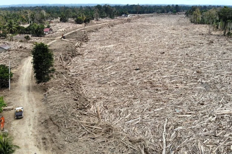
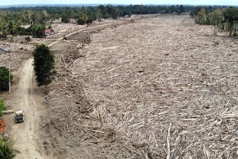
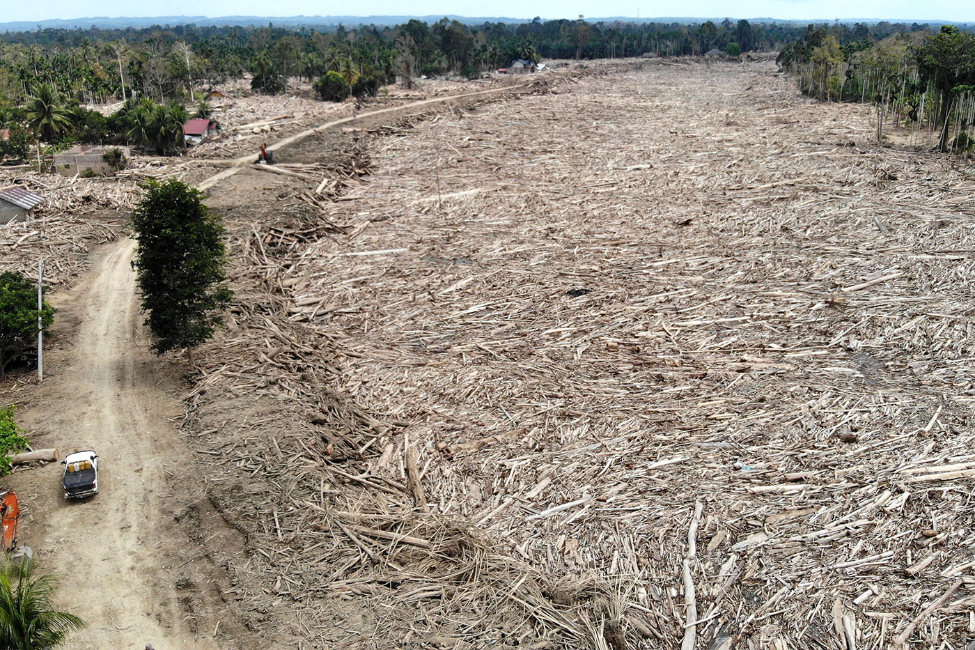
The Indonesian government has intensified its comprehensive evaluation of the devastating series of natural disasters that struck the regions of Sumatra and Aceh toward the end of last year, focusing on the critical intersection between extreme weather events and human-induced environmental degradation. While the emergence of Tropical Cyclone Senyar has been identified as a primary meteorological trigger, authorities are now meticulously investigating how systemic policy failures and land-use mismanagement may have exacerbated the scale of the catastrophe. Widhi Handoyo, the Director of Environmental Impact Prevention for Regional and Sectoral Policies at the Ministry of Environment (KLH), confirmed the gravity of the situation, reporting that the disasters resulted in the total disappearance of 22 villages, marking one of the most severe displacement events in recent regional history.
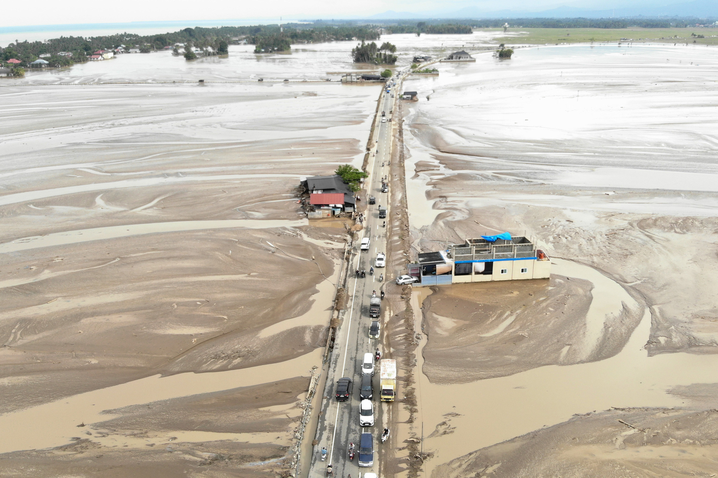
The nature of the late 2025 disaster has drawn chilling comparisons to the 2004 Indian Ocean Tsunami, though with a distinct and terrifying mechanical difference. During a webinar titled "Sumatra Disaster: What’s Next?" held on Wednesday, April 22, 2026, Handoyo noted that while the 2004 tsunami involved a massive influx of water from the sea toward the land, the recent Sumatran disasters functioned in reverse. Massive volumes of water, debris, and sediment originated in the highland upstream areas (hulu) and swept down with catastrophic force toward the coastal downstream regions (hilir). This "inland tsunami" effect caused fatal levels of destruction, wiping out infrastructure and residential areas that were previously considered safe from maritime threats.
Investigating the Human Element in Environmental Catastrophe
The Ministry of Environment is currently conducting a deep-dive analysis across the three most severely impacted provinces: Aceh, North Sumatra (Sumut), and West Sumatra (Sumbar). The central question of the investigation is whether the disaster was an unavoidable "act of God" or if it was significantly worsened by human error, specifically regarding regional planning, policy implementation, and the granting of industrial permits in ecologically sensitive zones. Preliminary findings by the ministry suggest that the highest levels of environmental pressure were recorded in areas that should have been strictly protected, including conservation zones, mangrove ecosystems, and cultural heritage sites.
Conversely, in areas designated for cultivation and economic activity, the highest pressures were found within the fisheries, defense, and energy mining sectors. Handoyo emphasized that spatial planning (Rencana Tata Ruang Wilayah or RTRW) is intended to serve as the definitive blueprint for regional development. However, a significant "implementation gap" has been identified between these official plans and the reality on the ground. The government is now auditing the Strategic Environmental Assessments (KLHS) of the three provinces to determine if they comply with Government Regulation (PP) No. 46 of 2016 and Ministry of Environment and Forestry Regulation No. 3 of 2024.
The data from Aceh is particularly concerning. The ministry found that the greatest spatial pressure occurred within protected forests and mangrove belts, while the "cultivation" zones were dominated by aggressive mining and tourism expansion. Handoyo pointed out that while the procedural drafting of these environmental assessments appeared correct on paper, they lacked substantive analysis regarding the actual geophysical characteristics and historical disaster risks of the terrain.
The Mismatch Between Ecology and Economy
One of the most damning revelations from the ongoing government study is the systematic mismatch between ecological functions and spatial allocation. Many areas that possess high bio-physical value as protective zones—essential for absorbing rainfall and stabilizing soil—have been reallocated for intensive cultivation, such as large-scale plantations and high-density residential settlements. This shift in land use has left the region with an dangerously high exposure to "extreme hydrometeorological hazards."
Current zoning maps indicate that significant development continues to occur in areas historically prone to flash floods and landslides. Handoyo cited research by Professor Dwikorita Karnawati, which indicates that many of the locations recently hit by flash floods have a "paleo-flood" history, meaning they were sites of massive flooding in ancient times. Despite this geological history, these areas underwent ecological degradation as protective forests were converted for economic gain. The Ministry has issued a stern warning that future spatial planning must prioritize disaster risk reduction over short-term economic exploitation.
Meteorological Anomalies: The Role of Cyclone Senyar
The scientific community has also weighed in on the unprecedented nature of the weather patterns. Firman Syahifuddin, a passive seismic expert and lecturer at the Sepuluh Nopember Institute of Technology (ITS), highlighted the anomaly of Tropical Cyclone Senyar. Traditionally, tropical cyclones do not form or maintain strength so close to the equator due to the weak Coriolis effect. However, Senyar defied historical norms, battering Sumatra with rainfall exceeding 200 millimeters per day—a level far beyond the capacity of local drainage systems and soil absorption.
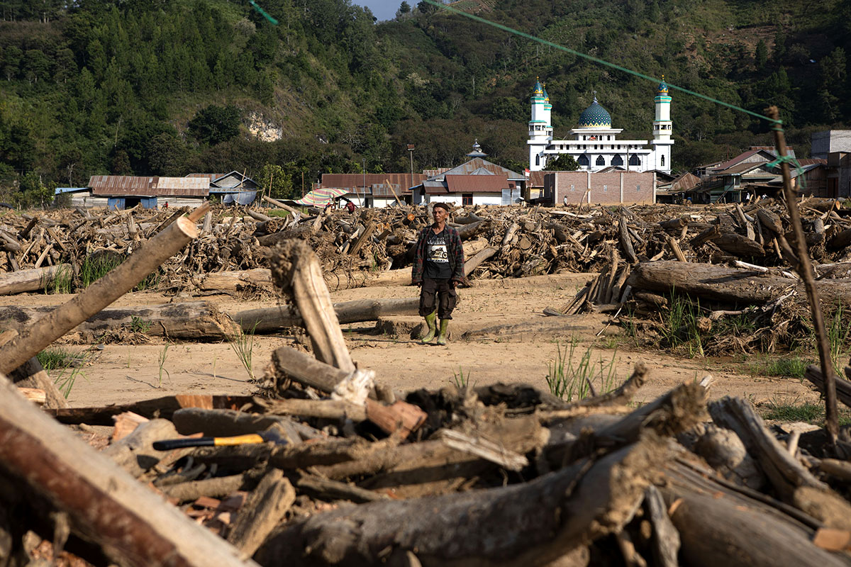
This extreme precipitation triggered a "triple threat" of disasters: flash floods, landslides, and stagnant inundation. In many residential areas, the material carried by flash floods—a mixture of mud, boulders, and timber—was so voluminous that it buried homes under two meters of sediment. Syahifuddin noted that such an event, where settlements are buried under two meters of material, is a "once-in-a-century" occurrence in Indonesia. The velocity of these flows, particularly along the Bukit Barisan mountain range, reached speeds of 6 to 10 meters per second, allowing the water to transport massive boulders and uprooted trees with ease.
The Bukit Barisan range itself presents a unique geological challenge. As a volcanic region, the rocks undergo intense weathering, transforming volcanic material into loose soil. When saturated by extreme rainfall, the geochemical bonds of the soil weaken, leading to the massive slope failures seen in late 2025. Syahifuddin argued that while the geology is fixed, the "runoff coefficient"—the amount of water that flows over the surface rather than soaking in—is something humans can control. Denser forests provide better absorption, whereas the current trend of deforestation has turned the mountains into slides for rainwater.
Technological Solutions and Data-Driven Mitigation
In response to these challenges, ITS is currently developing an "Advanced Disaster Decision Support System." This platform aims to integrate dynamic data, such as real-time rainfall averages and soil saturation levels, to provide more accurate early warnings. Unlike static maps, this system adjusts based on the latest satellite imagery and sensor data. Currently being trialed in East Java, the hope is to roll out this technology across Sumatra to help policymakers make informed decisions about evacuations and land-use restrictions.
Agus Muhammad Hatta, the Vice-Rector of ITS for Innovation and Cooperation, emphasized that Sumatra is a land of "unique natural gifts and immense threats." The island sits on an active subduction zone where the Indo-Australian plate meets the Eurasian plate. In addition to hydrometeorological risks, the region faces the "Mentawai-Siberut" fault, which has been accumulating energy for over 200 years. Hatta argued that a "science-based mitigation" strategy must be the third pillar of national safety, alongside policy and infrastructure. This involves "revolving the system" to adopt satellite-based sensors and fostering multi-stakeholder synergy to restore the earth’s "ecological carrying capacity."
The Warning from East Java: A National Crisis
The environmental crisis is not limited to Sumatra. The Indonesian Forum for the Environment (Walhi) in East Java has expressed grave concerns that the climate crisis is accelerating disaster timelines across the archipelago. Between November 2025 and March 2026, East Java recorded 284 floods and 444 landslides. Pradipta Indra Ariono, Executive Director of Walhi East Java, criticized local governments for revising spatial plans (RTRW) without first completing the mandatory Strategic Environmental Assessments (KLHS).
In some cases, local authorities have been accused of "whitewashing" spatial violations—legalizing illegal developments in protected zones during the revision of regional regulations rather than enforcing the law. Ariono highlighted specific instances of deforestation in the Prigen area of Pasuruan Regency, where forests were cleared to make way for 51 luxury villa plots. Furthermore, the push for "National Strategic Projects" (PSN), including 11 planned geothermal projects in mountainous regions, is seen by environmentalists as a potential catalyst for future disasters.
"The threat is right in front of our eyes," Ariono warned. "If we continue to force industrial and exploitative development into water catchment areas and volcanic slopes, the resulting disasters will eventually destroy us."
Conclusion: A Call for Systemic Reform
The disasters in Sumatra and Aceh serve as a grim harbinger of a future defined by climate volatility and the consequences of ecological neglect. The loss of 22 villages is a stark reminder that the "carrying capacity" of the land has been breached. As the Ministry of Environment concludes its investigation, the focus shifts to whether the Indonesian government will have the political will to enforce stricter spatial laws, cancel high-risk permits, and prioritize the restoration of protective ecosystems over industrial expansion.
The integration of advanced technology, such as the ITS decision support system, offers a path toward better preparedness, but experts agree that technology alone cannot fix a broken policy framework. The "language of nature," as described by regional experts, has spoken clearly through the mud and debris of Sumatra. The next steps taken by the government will determine whether Indonesia becomes a global leader in climate resilience or remains a cautionary tale of the costs of environmental mismanagement.