 Nila Kartika Wati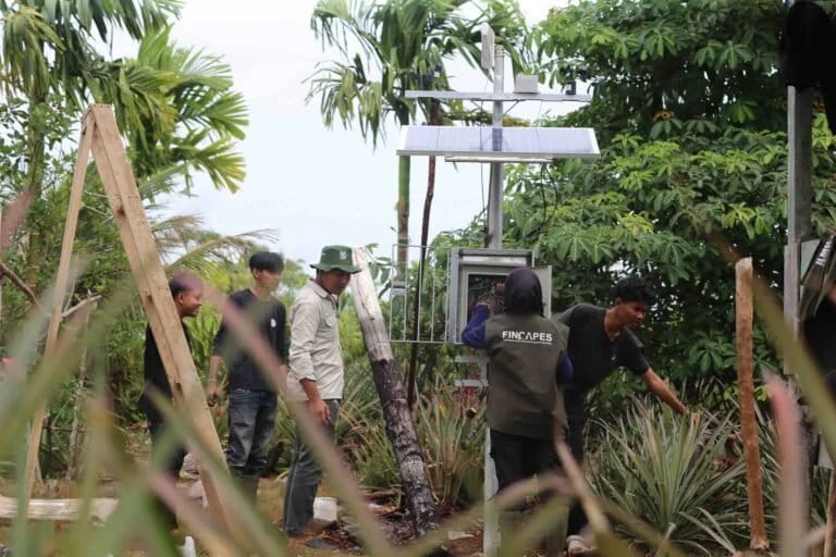
The thin plume of smoke curling behind the areca nut grove in the village of Air Merah, Sungai Gelam, Muaro Jambi, initially appeared as a minor, manageable incident. However, within hours, the smoldering embers transformed into a localized catastrophe. The fire rapidly infiltrated the deep peat layers, turning a routine agricultural nuisance into a complex environmental emergency. Despite the frantic efforts of local residents and emergency responders, the battle was severely hindered by a critical infrastructure failure: the local canal network, intended for water management, had run completely dry, leaving firefighters with no access to the water necessary to quench the deep-seated flames.
A Chronology of Destruction
The fire at Air Merah serves as a stark case study in the rapid escalation of peatland combustion. What began as a small outbreak quickly expanded, traversing more than a kilometer of landscape and ultimately incinerating an estimated 130 hectares of land. The suppression operation was massive in scale, involving a coordinated effort between 300 ground personnel and three helicopters conducting water bombing missions. It took ten grueling days to fully extinguish the fire, highlighting the extreme difficulty of suppressing peatland fires once they penetrate the subsurface.
According to data released by KKI Warsi, a prominent environmental watchdog, the devastation in Jambi is not an isolated event. By September 3, 2026, the cumulative total of forest and land fires in the Jambi region had surged past the 10,000-hectare threshold. This figure represents a worrying trend for a province that has become synonymous with the cyclical struggle against fire, smoke, and habitat loss.
The Cycle of Recurrence and Landscape Degradation
For the inhabitants of Air Merah, the trauma of fire is a recurring narrative rather than an anomaly. The community-managed forest area, known as Hutan Kemasyarakatan (HKm) Air Merah, has been a frequent casualty of fire over the past decade. Significant blazes were recorded in 2015 and 2019, with further outbreaks occurring in 2023, 2024, and the current 2026 season.
The vulnerability of this region is not merely a matter of bad luck or extreme weather; it is the result of systematic landscape modification. Decades of land degradation, rapid forest conversion, the expansion of palm oil monocultures, and the widespread construction of drainage canals have fundamentally altered the hydrology of the peat swamp. Peat, by its nature, acts as a sponge, holding vast quantities of water that keep the ecosystem cool and fire-resistant. When canals are dug to drain land for agriculture, the peat dries out, becoming highly combustible fuel that can burn for weeks, if not months, below the surface.
Expert Analysis: The Failure of Reactive Policy
The scientific community has long warned that the current reactive approach to fire management is fundamentally flawed. Sri Wilarso Budi, a Professor at IPB University, emphasizes that these disasters are largely predictable given the availability of modern climate forecasting tools.
"The situation should have been anticipated," Professor Budi stated. "We cannot afford to wait until the fire has already grown into a major conflagration before mobilizing resources. By that stage, the intervention is almost always too late."
According to Budi, effective peatland management must transcend the arbitrary boundaries of land concessions or individual property lines. Peatlands function as unified hydrological units; therefore, damage in one section inevitably destabilizes the water table across the entire surrounding area. The practice of installing canal blocks is often delayed until the land is already parched, at which point it is ineffective. Once peat reaches a state of critical dehydration, it requires three to four years of consistent water table management to return to a stable, fire-resistant state.
The Biological Cost of Peat Loss
The environmental implications of these fires extend far beyond the immediate loss of vegetation. Peat is a carbon-rich soil that takes millennia to accumulate. In tropical conditions, peat forms at an agonizingly slow rate—roughly 0.1 to 2 millimeters per year. When a fire consumes a mere 10 centimeters of peat, it represents the destruction of anywhere from 50 to 1,000 years of ecological history. This carbon debt is almost impossible to "recover" in a human timeframe, contributing significantly to regional greenhouse gas emissions and worsening the very climate conditions that make the fires more frequent.
A Paradigm Shift: From Suppression to Prevention
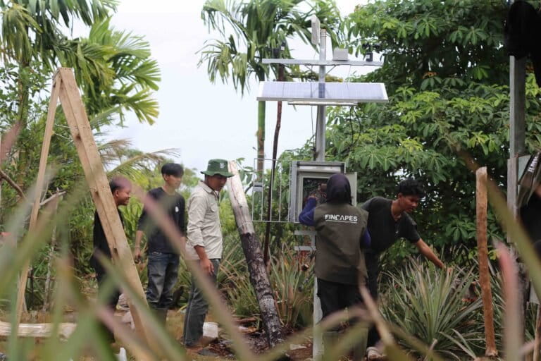
In response to the recurring failures of traditional firefighting methods, the Fincapes project has initiated a transition toward technology-driven prevention. In the HKm Air Merah area, the project has installed two low-cost, high-efficiency early warning devices. These units act as the "eyes and ears" of the forest, utilizing a suite of sensors to monitor critical metrics: atmospheric smoke concentration, temperature, rainfall, wind direction, soil moisture, and, most importantly, groundwater levels.
The system is designed for immediate impact. When sensor readings cross a predetermined threshold indicating an increased risk of fire, the device triggers an audible siren. Simultaneously, real-time data is transmitted to a web-based portal accessible to local community leaders and authorities. This allows for rapid, targeted intervention before a small fire has the chance to penetrate the deep peat layers.
Restorative Agriculture and Community Resilience
Beyond technological monitoring, the project is heavily invested in physical restoration. A 47-hectare area is currently undergoing an intensive rehabilitation program. Rather than planting a monoculture, the initiative involves interspersing native peat-swamp species—such as Jelutung (Dyera polyphylla), Balangeran (Shorea balangeran), and Pulai (Alstonia scholaris)—among the existing pineapple and areca nut gardens maintained by local farmers.
The target is to introduce 80,000 seedlings into the landscape through a variety of agroforestry models. This approach serves a dual purpose: it restores the natural water-retention capacity of the peatland while providing sustainable economic alternatives for the local population. By diversifying their income streams through high-value native species, farmers are less dependent on the expansion of fire-prone oil palm monocultures.
Looking Toward 2028: A Model for the Future
The ultimate objective of these efforts is to transform the Sungai Gelam landscape into a flagship model for community-based peatland restoration by 2028. For the people of Air Merah, who have spent years watching their land burn, this shift in strategy offers something they have long been denied: the capacity for agency.
The integration of local knowledge with low-cost, high-tech monitoring tools empowers the community to transition from passive victims of environmental disasters to active stewards of their landscape. While the path toward complete restoration remains long and arduous, the transition from a purely reactive stance to a preventive, science-led strategy provides a blueprint that could potentially be scaled to other high-risk regions across Indonesia.
The battle against fire in the peatlands of Jambi remains one of the most significant environmental challenges of the decade. As temperatures rise and extreme weather patterns intensify, the success of community-led, technologically supported prevention initiatives like those in Air Merah will be a critical indicator of whether these vital ecosystems can be preserved for future generations. The data is clear: without a fundamental change in how we manage the water table and how we empower those living on the front lines, the cycle of smoke and ash will only continue to accelerate.