 Nila Kartika Wati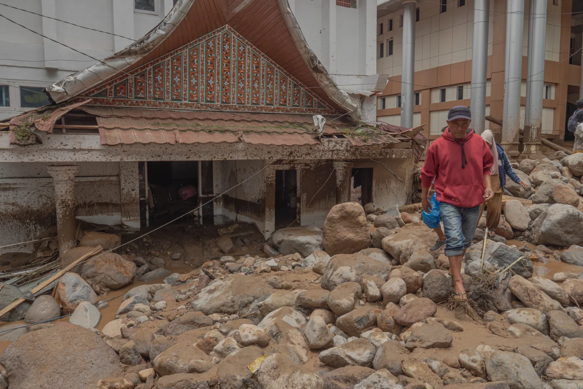
The tranquil evening in Arosuka, the administrative heart of Solok Regency, West Sumatra, was shattered on Monday, September 21, 2026, when a devastating flash flood—locally known as a galodo—tore through the region. Triggered by relentless torrential rainfall, the disaster claimed at least one life, left one person missing, and inflicted widespread destruction upon critical government infrastructure, private residences, and local transportation networks. The incident, which occurred around 8:00 PM local time, has prompted urgent calls from environmental experts and civil society organizations for a fundamental overhaul of regional spatial planning and forest management in the upstream areas of Mount Talang.
A Night of Terror: The Chronology of Destruction
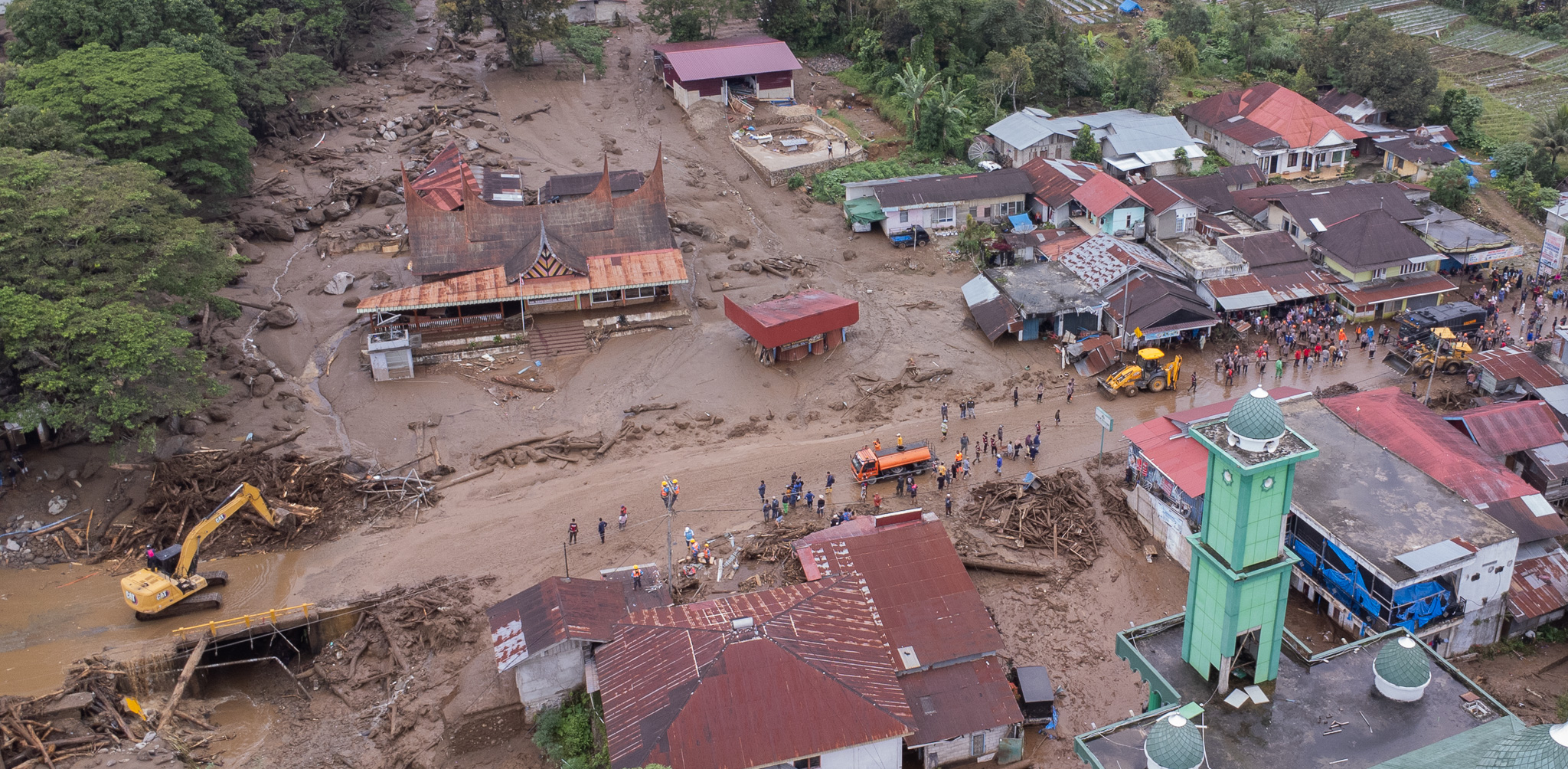
For many residents of Arosuka, the catastrophe arrived with little warning. Ali Priyono, a local street vendor operating near the Solok Regent’s Office, recounted the harrowing moments when the landscape transformed from calm to chaos. As he served customers, a sudden, thunderous roar emanated from the upstream river section. Within seconds, the riverbanks, previously contained, were overwhelmed by a torrent of water carrying massive logs, boulders, and debris.
"It was a sound I had never heard in the years I’ve lived here since 2008," Priyono recalled. Recognizing the immediate danger, he abandoned his business to reach his family. Amidst the deafening sounds of structural failure as trees and stones slammed into buildings along the river, Priyono managed to evacuate his wife and three children to higher ground. Although his home was subsequently buried under a thick layer of mud and rock, his family survived.
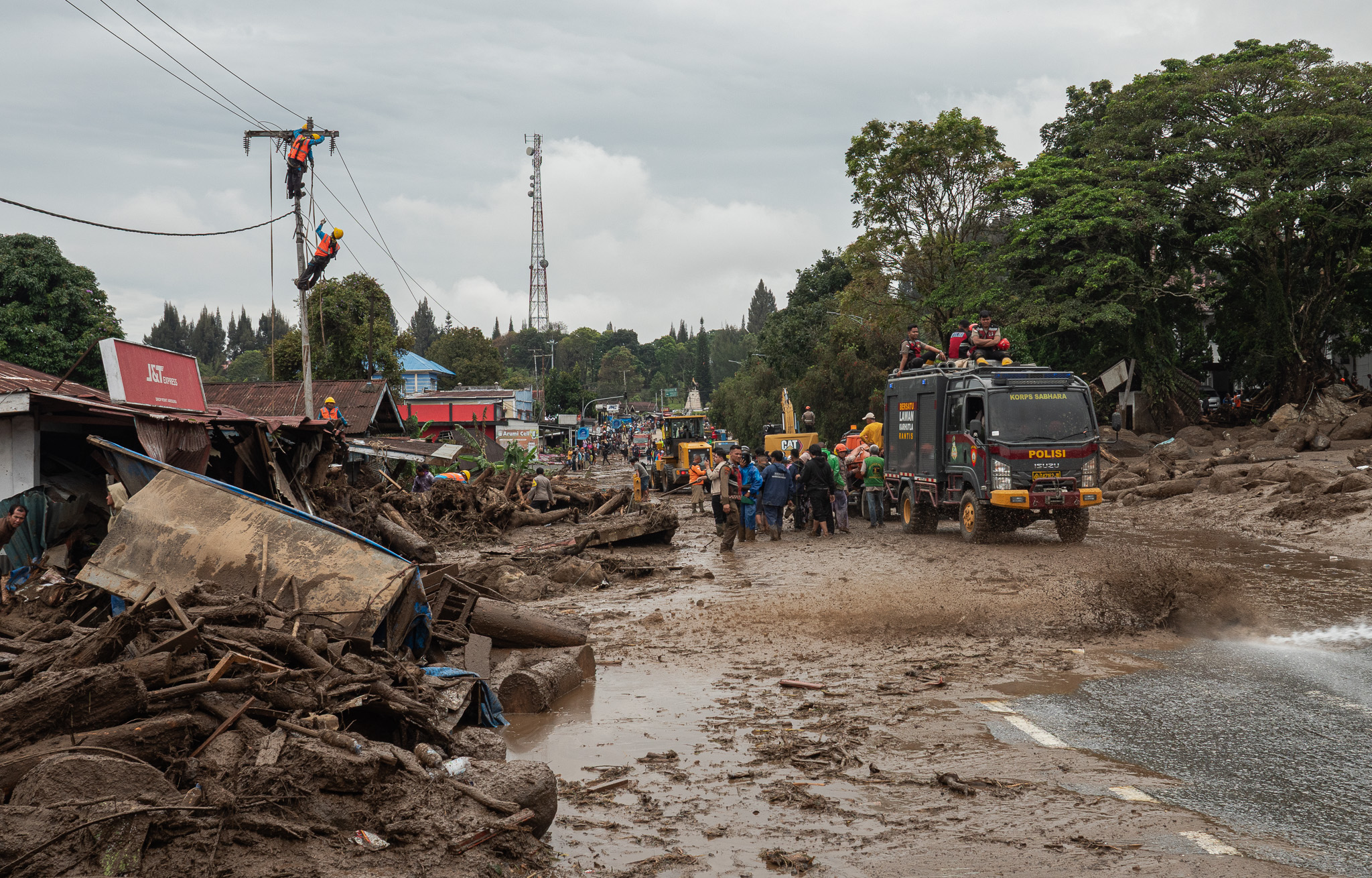
By Tuesday morning, the true scale of the disaster became apparent. The search and rescue operation, involving a massive task force of approximately 600 personnel, scoured the riverbanks. The body of one victim was recovered near the Koto Gaek and Sungai Jawi-Jawi confluence at approximately 1:30 PM on September 22. Official reports from the West Sumatra Police Medical and Health Division indicate that in addition to the fatality and the one missing person, seven individuals suffered minor injuries, while one person sustained serious injuries.
The Impact on Governance and Public Infrastructure
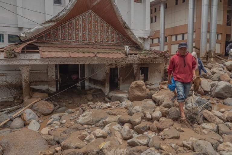
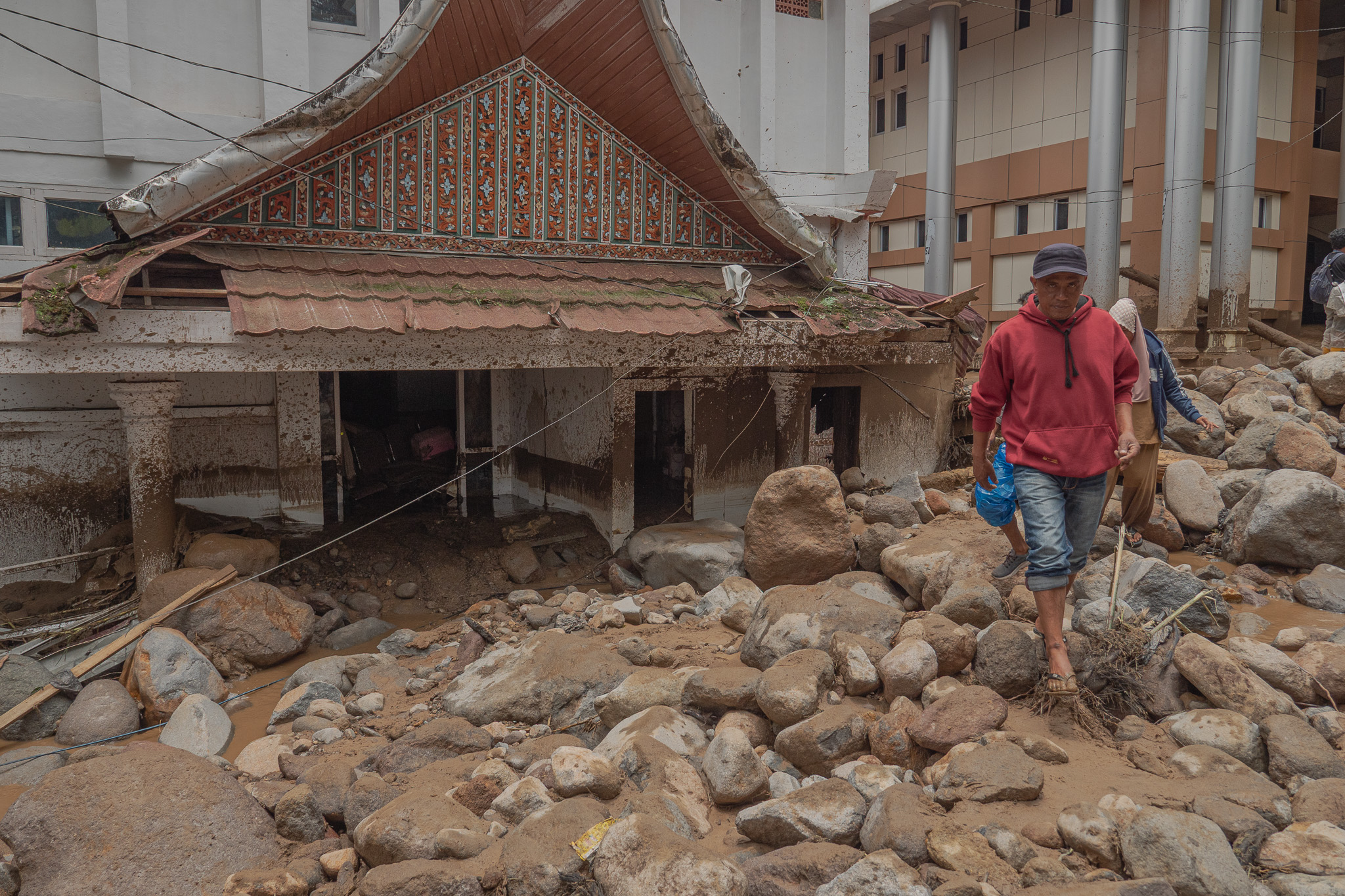
The physical damage to the regional administrative center is unprecedented. According to the West Sumatra Regional Disaster Management Agency (BPBD), at least 10 government office buildings were severely impacted. The destruction was not limited to water damage; massive quantities of sediment, mud, and debris left the buildings structurally compromised.
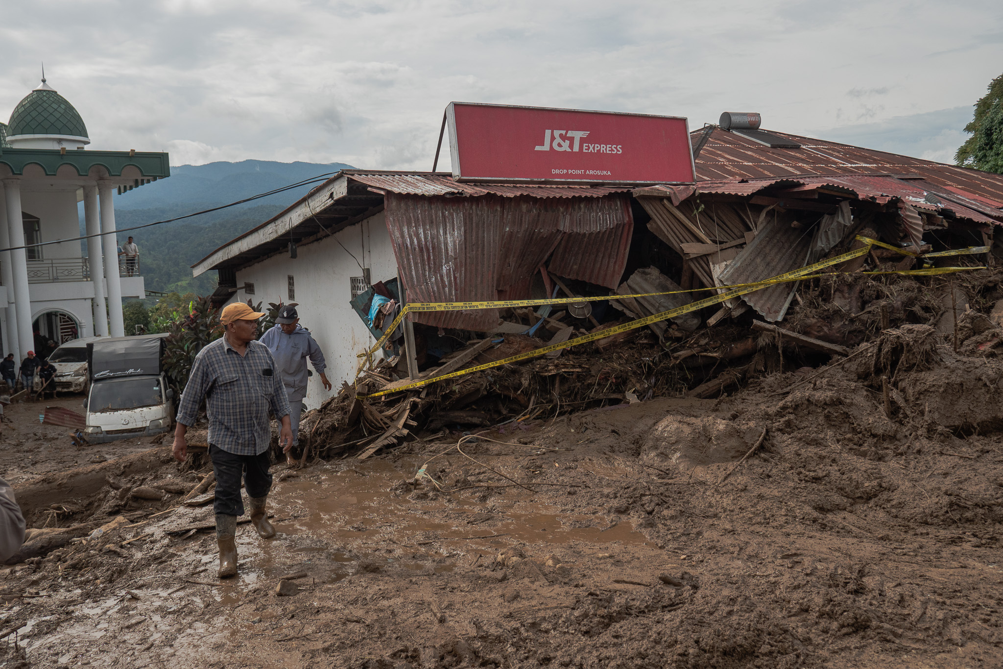
The Solok Regional House of Representatives (DPRD) building was among the hardest hit, with debris reaching depths of 60 centimeters. Similarly, the Department of Public Works and Public Housing (PUPR) and the Department of Community Empowerment and Nagari (DPMN) offices were buried under 30 centimeters of sludge. Other affected facilities include the Regional Revenue Agency (Bapenda), the Regional Development Planning and Research Agency (Bapelitbang), the Inspectorate, and various departments overseeing tourism, agriculture, health, and human resources. Beyond the buildings, seven official government vehicles were rendered total losses after being swept away or crushed by the force of the debris.
Environmental Context and Historical Precedent
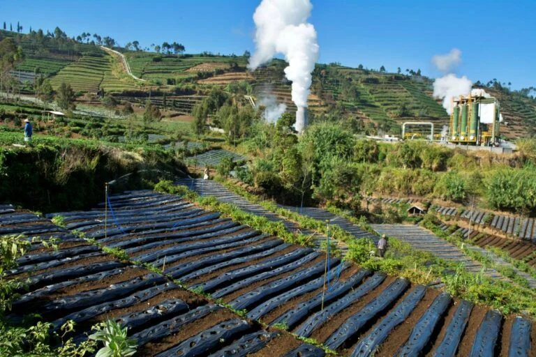
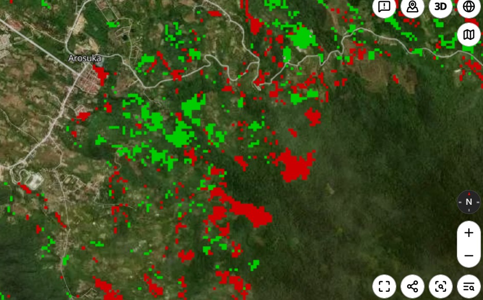
Environmental experts suggest that the disaster in Arosuka is symptomatic of deep-seated ecological degradation. The area surrounding Mount Talang serves as the primary catchment zone for the Batang Lembang river system. Historically, this region was heavily forested, with approximately 75% of the upstream area classified as protected forest. Today, however, that figure has dwindled to an estimated 25%.
Research conducted by the Indonesian Forum for the Environment (WALHI) highlights a staggering loss of forest cover. Between 2000 and 2024, approximately 6,000 hectares of forest in Solok were converted into agricultural land. This includes 1,330 hectares currently exploited by illegal gold mining operations. These extractive activities have compromised the soil structure, altered natural drainage patterns, and destabilized slopes—factors that significantly exacerbate the risk of landslides and flash floods during extreme weather events.
Tommy Adam, Director of WALHI West Sumatra, argued that the disaster should not be viewed merely as a natural event, but as a failure of policy and spatial governance. "The risk of disaster in this area is not new," Adam stated. "Documents from the Center for Volcanology and Mitigation of Geological Hazards (PVMBG) from 2007 clearly identified this region as a high-risk zone for volcanic lahars and flash flooding. The question remains: why were these warnings ignored in the planning and development of the regency’s administrative hub?"
The Role of Meteorological Dynamics
The Meteorology, Climatology, and Geophysics Agency (BMKG) reported that the disaster was precipitated by an extreme rainfall event, measuring 94 millimeters per day. Andri Ramadhani, the Acting Deputy for Meteorology at BMKG, noted that while much of Indonesia is currently experiencing a dry season, localized climatic patterns in mountainous regions like West Sumatra continue to pose significant risks for extreme weather.
"The transition period from the dry season to more unpredictable weather patterns requires heightened vigilance," Ramadhani explained. He confirmed that the agency had issued early warnings for the region three to seven days prior to the event. The agency continues to warn residents in Northern Sumatra, Kalimantan, Sulawesi, and Papua to monitor real-time updates as these regions remain in a state of climatic transition.
Policy Implications and the Need for Reform
In the wake of the tragedy, West Sumatra Governor Mahyeldi Ansharullah has pledged a comprehensive evaluation of the security and viability of the Solok administrative offices. The government has committed to stricter monitoring of land use in the upstream areas, particularly in zones designated as Other Use Areas (APL), where residential and commercial development has encroached upon vulnerable landscapes.
"We must learn from this," the Governor stated. "We are currently assessing the causes and will establish more rigorous controls on land clearing activities to ensure the safety of our citizens."
However, experts remain skeptical that minor adjustments will suffice. Indang Dewata, an environmental specialist at the State University of Padang (UNP), emphasized that without a shift toward agroforestry and robust reforestation, the cycle of disaster will likely continue. "The sediment load in the rivers is a direct consequence of upstream erosion," Dewata noted. "The presence of large logs in the floodwaters is evidence of deforestation; these trees, once essential for soil retention, now act as projectiles that worsen the damage to downstream infrastructure."
Future Mitigation and Sustainability
The disaster has reignited the debate over the implementation of Regional Regulation (Perda) Number 1/2013 regarding the Spatial Planning of the region. Critics point to the proliferation of villas and cafes on steep slopes leading to the Twin Lakes area as evidence of regulatory failure. These developments often lack the necessary environmental impact assessments and violate the required setbacks for river buffers.
Isril Berd, Chairman of the West Sumatra Watershed Forum, highlighted the urgency of re-evaluating the "catchment area" management. "Arosuka sits on a steep, geologically active landscape within the Bukit Barisan range," Berd explained. "The combination of high-intensity rain, steep topography, and the loss of vegetation creates a ‘perfect storm’ scenario. We need to stop building in the path of natural water movement."
The disaster in Arosuka serves as a stark reminder of the escalating tension between regional development and ecological limits. As the recovery process begins, the focus for the Solok Regency administration must shift from post-disaster cleanup to the implementation of long-term, science-based mitigation strategies. This includes restoring the integrity of riverbanks, enforcing bans on illegal land conversion, and integrating climate risk assessments into every layer of future infrastructure projects.
For the survivors of the Arosuka flash flood, the path forward is uncertain. The loss of life and the destruction of the administrative center have left a scar on the community that will take years to heal. The challenge for local and provincial leaders now is to prove that this tragedy will serve as the final warning, rather than a precursor to further avoidable loss of life. By prioritizing environmental resilience over short-term expansion, there remains a narrow window to restore the natural defenses of the Batang Lembang watershed and protect the residents of Solok from the recurring threats posed by an increasingly volatile climate.