 Nila Kartika Wati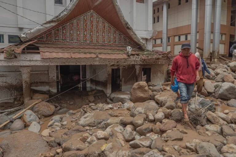
The quiet evening of Monday, September 21, 2026, in Arosuka, the administrative seat of Solok Regency, West Sumatra, was violently interrupted by a catastrophic flash flood, locally known as "galodo." What began as a routine rainy evening quickly escalated into a disaster that claimed lives, displaced hundreds, and paralyzed the local government infrastructure. As the dust settles and recovery efforts begin, the event has sparked an urgent debate regarding the intersection of extreme meteorological conditions and the long-term degradation of the region’s ecological integrity.
The Chronology of a Disaster
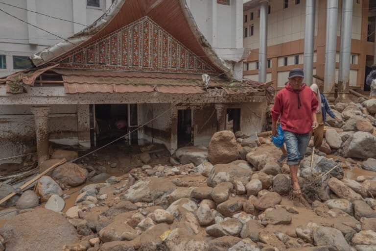
The catastrophe unfolded with terrifying speed. At approximately the time when local vendors were closing their stalls, a thunderous roar echoed from the direction of the upstream slopes of Mount Talang. Ali Priyono, a local resident who has operated a small fried food business near the Solok Regent’s Office since 2008, described the sensory assault of the event. Within seconds of the initial rumbling, a wall of water, thick with sediment, timber, and massive boulders, breached the riverbanks and inundated the area surrounding the government offices.
Ali’s experience serves as a harrowing microcosm of the event: he abandoned his business to rush home, successfully evacuating his wife and three children to higher ground just before their residence was overwhelmed by a deluge of mud and debris. While his family survived, their home was rendered uninhabitable, buried under layers of alluvial waste.
By the time the surge subsided, the damage was extensive. Preliminary reports from the West Sumatra Regional Disaster Management Agency (BPBD) confirmed the destruction of ten government office buildings and seven official vehicles. Tragically, the human cost included one confirmed fatality and one individual reported missing, with numerous others sustaining injuries. Governor Mahyeldi Ansharullah, who surveyed the damage, noted that between 100 and 150 houses were directly impacted, affecting approximately 300 residents.
Meteorological Context and Data
The Indonesian Agency for Meteorology, Climatology, and Geophysics (BMKG) recorded a significant precipitation event leading up to the flood. Data indicate that rainfall intensity in the Solok area reached 94 millimeters within a single 24-hour period. Andri Ramadhani, Acting Deputy for Meteorology at BMKG, explained that the high-intensity rainfall in the upper reaches of the mountainous terrain acted as the immediate trigger for the flash flood, forcing a rapid discharge of water and sediment through the downstream river networks.
However, meteorologists and environmental experts agree that while the rain was the catalyst, it was not the sole cause. In the world of hydrology and disaster risk reduction, a flash flood of this magnitude—carrying boulders and heavy timber—suggests a failure in the landscape’s ability to regulate water flow. The intensity of 94mm/day, while high, is not unprecedented in tropical regions; the severity of the damage in Arosuka points toward an underlying vulnerability in the region’s environmental management.
The Ecological Warning Signs
The catastrophe in Arosuka has brought long-standing environmental concerns to the forefront. Tommy Adam, Director of the West Sumatra chapter of the Indonesian Forum for the Environment (WALHI), argues that the disaster was a predictable consequence of decades of land-use mismanagement.
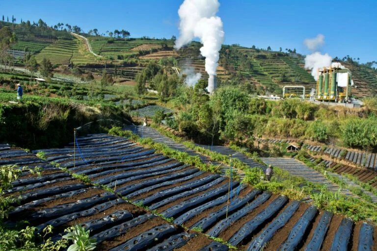
According to WALHI’s analysis, the Batang Barus district—a critical catchment area for the region—has suffered a severe loss of forest cover. Between 1995 and 2024, approximately 700 hectares of forest were cleared. On a broader scale, within Solok Regency, nearly 6,000 hectares of forest were converted into agricultural land between 2000 and 2024. This massive deforestation significantly reduces the soil’s infiltration capacity, leading to increased surface runoff and higher erosion rates.
Furthermore, the vulnerability of the Arosuka area was not a secret. A hazard map for the Mount Talang region, published as early as 2007, identified the current location of the Solok Regent’s office and surrounding residential areas as high-risk zones for volcanic and geological material transport. The failure to integrate these maps into local spatial planning and building permits has now come under intense scrutiny. Critics are questioning how high-value government infrastructure was allowed to be constructed in the path of a potential disaster, and whether the necessary protective buffer zones along the riverbanks were ever enforced.
Professional Perspectives on Landscape Instability
Isril Berd, Chair of the West Sumatra Watershed Forum, highlighted the physical characteristics of the terrain as a compounding factor. The topography of the Mount Talang foothills is defined by steep slopes and loose, unstable material, including volcanic debris and unconsolidated soil. In a stable, forested environment, vegetation acts as a mechanical stabilizer for these slopes. When the forest is removed, the combination of steep gradients and intense rain turns these hillsides into conduits for debris flows.
"We must look at the landscape as a whole," Berd stated. "The conversion of land in the upper reaches changes the hydrological response of the entire watershed. While the rain triggered the event, the terrain was primed for disaster by the loss of natural slope protection."
The academic community has echoed these concerns. Indang Dewata, an expert in environmental science, emphasizes that the path forward requires a shift from reactive disaster management to proactive landscape restoration. This includes systematic re-afforestation, the implementation of agroforestry systems that protect soil integrity while supporting local livelihoods, and a radical overhaul of spatial planning laws that currently favor development over risk mitigation.
Implications for Future Governance
The tragedy in Arosuka serves as a stern reminder of the "new normal" in disaster risk. As climate change increases the frequency and intensity of extreme weather events, traditional infrastructure and planning models are proving inadequate. For the administration of Solok, the immediate priority is the humanitarian response—clearing the mud, housing the displaced, and restoring essential services. However, the long-term challenge is far more complex.
The regional government now faces pressure to conduct a comprehensive audit of all development projects in the vicinity of the Mount Talang watershed. This involves:
- Risk Re-assessment: Updating hazard maps using contemporary LIDAR and satellite imagery to reflect the current state of land degradation and shifting river paths.
- Enforcement of Spatial Planning: Reviewing building permits and potentially restricting development in high-risk zones, including riverine buffer zones (sempadan sungai).
- Watershed Restoration: Launching large-scale re-vegetation programs to stabilize the slopes in the upper reaches of the Batang Barus district.
- Early Warning Systems: Enhancing the local disaster communication network to ensure that residents in high-risk zones receive timely alerts, reducing the reliance on visual or auditory cues like the "roar" of an approaching flood.
Conclusion
The flash flood of September 21, 2026, is a stark indictment of a development trajectory that has consistently prioritized short-term expansion over long-term environmental sustainability. The debris-laden streets of Arosuka are the physical manifestation of years of forest loss, soil erosion, and ignored geographical warnings.
As the recovery phase commences, the residents of Solok are left to grapple with the loss of their homes and livelihoods. Yet, the tragedy also provides a window of opportunity for policy change. If the lessons of this disaster are internalized, it could lead to a more resilient, science-based approach to governing the mountainous landscapes of West Sumatra. Without such a transformation, the cycle of disaster and recovery will remain a permanent feature of the region’s future, with each successive storm potentially proving even more devastating than the last. The "galodo" was not merely a natural phenomenon; it was a systemic failure—and the remedy must be equally systemic.