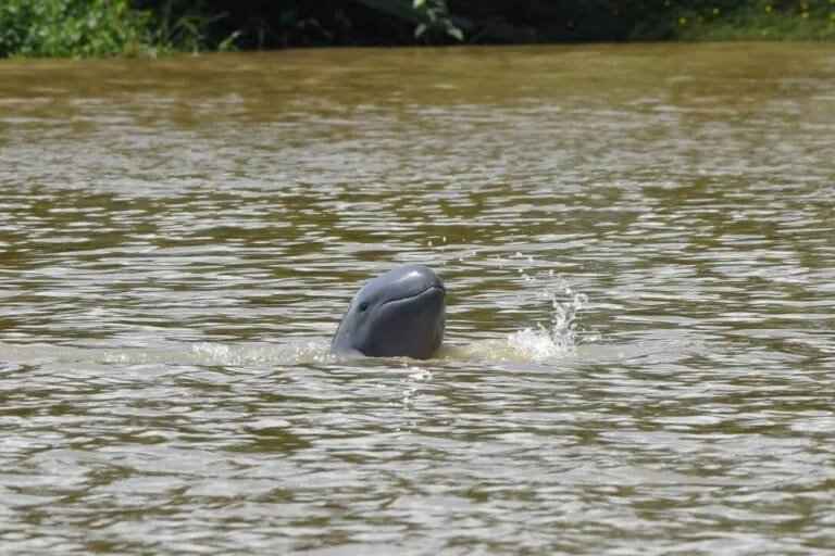
The geographical landscape of South Sumatra is undergoing a profound and irreversible transformation that threatens to permanently erase the province’s historical maritime identity. Once characterized by a vast network of hundreds of small islands and deltas nestled within expansive wetlands, the region’s topographical profile has shrunk to a mere 23 remaining islands. While iconic landmarks such as Pulau Kemaro and Pulau Kreto continue to stand as isolated remnants within the Musi River, hundreds of other landforms have vanished, swallowed by a massive and systematic alteration of the natural landscape. This disappearance is not a result of natural erosion or rising sea levels alone but is primarily the consequence of aggressive land conversion and a fundamental shift in how the region manages its water and soil resources.
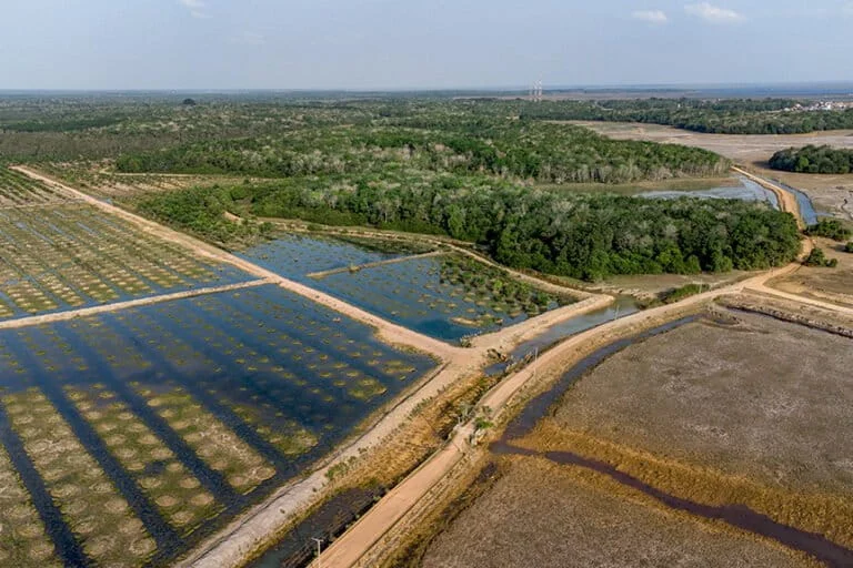
For centuries, the identity of South Sumatra, particularly its capital city of Palembang, was inextricably linked to its aquatic environment. Historically dubbed the "Venice of the East" by European explorers, the region thrived on a complex interaction between the Musi River and its surrounding peatlands and swamps. However, contemporary development models have prioritized terrestrial expansion over hydrological preservation. The conversion of hundreds of thousands of hectares of wetlands and peat swamps, particularly in the regencies of Ogan Komering Ilir (OKI) and Ogan Ilir, has fundamentally redrawn the map. These areas, once vibrant ecosystems of interconnected waterways, have been drained and filled to accommodate palm oil plantations, industrial forest plantations (HTI), residential complexes, and sprawling road infrastructure.
The Mechanism of Disappearance: Land Conversion and Infrastructure
The "extinction" of these islands is a phenomenon driven by the physical merging of smaller landmasses with the mainland. In the traditional landscape of South Sumatra, islands were defined by the water that surrounded them—tributaries, streams, and seasonal floodplains. As development progressed, these water boundaries were systematically eliminated. The construction of "land-based" infrastructure, such as roads built on elevated embankments without adequate culverts or bridges, acted as dikes that severed the flow of water.
Over time, the process of "landfilling" or "reclamation" (locally known as penimbunan) has turned these islands into extensions of the urban and industrial sprawl. In Ogan Komering Ilir, the expansion of large-scale plantations required the extensive drainage of peatlands through the construction of canals. While these canals were designed to manage water for crops, they effectively lowered the water table, causing the surrounding wetlands to dry out and the once-distinct "islands" of higher ground to lose their geographical separation from the surrounding terrain. Consequently, what were once strategic outposts or unique ecological niches are now indistinguishable from the monotonous landscape of industrial agriculture.
A Chronology of Landscape Alteration
The shift from a maritime-centric society to a land-centric one in South Sumatra did not happen overnight but followed a clear trajectory of modernization that often ignored local ecological wisdom.
- The Pre-Industrial Era (Prior to 1970): During this period, the Musi River and its tributaries served as the primary highways of the province. Settlements were designed to be amphibious. The "islands" were seasonal; during the monsoon, they were refuges of dry land, and during the dry season, they were centers of agricultural activity.
- The Rise of Industrial Plantations (1980s – 2000s): The Indonesian government’s push for self-sufficiency and export-led growth saw the first major incursions into the peatlands of South Sumatra. Large swaths of Ogan Komering Ilir and Ogan Ilir were earmarked for conversion. This era marked the beginning of large-scale drainage projects that fundamentally altered the region’s hydrology.
- The Infrastructure Boom (2010 – Present): The focus shifted toward connecting the province via land. The construction of the Trans-Sumatra Toll Road and various provincial highways necessitated the filling of swamps. In Palembang, the demand for housing led to the filling of urban wetlands (lowlands), which historically acted as natural retention basins for the Musi River’s overflow.
Supporting Data: The Shrinking Wetland Footprint
Environmental data highlights the severity of this transition. South Sumatra possesses one of the largest peatland distributions in Sumatra, originally estimated at over 1.2 million hectares. However, data from environmental monitoring groups and satellite imagery analysis indicate that a significant portion of this area has been degraded or converted. In the last two decades alone, it is estimated that the province has lost a substantial percentage of its primary wetland cover to monoculture plantations.
The loss of the islands is a direct proxy for the loss of water storage capacity. According to hydrological studies, a single hectare of healthy peatland can store thousands of cubic meters of water. When hundreds of islands and their surrounding wetlands are "reclaimed" or drained, that storage capacity vanishes. This is reflected in the increasing frequency of "rob" (tidal floods) and flash floods in Palembang. While the city’s population has grown, the "space for water" has decreased by an estimated 70% in certain urban corridors, leaving the remaining 23 islands as the last bastions of the original deltaic system.

Cultural Amnesia and the Loss of Maritime Wisdom
The disappearance of the islands is accompanied by a deeper, more insidious loss: the "cultural amnesia" of the Palembang people. Historically, the local population did not view the Musi River as a mere body of fresh water; they referred to it as "the sea" (laut) and the small landmasses within it as "islands" (pulau). This nomenclature reflected a worldview that respected the vastness and power of the water.
Sociologists and historians point out that the traditional Palembang way of life was a masterclass in climate adaptation. The Rumah Rakit (raft houses) floated with the tides, ensuring that residents were never victims of flooding. The Perahu Kajang served as mobile homes and trading vessels, while Rumah Panggung (stilt houses) allowed water to flow freely beneath the living quarters without causing damage. In this maritime framework, water was a source of life, transport, and prosperity.
However, modern development has treated water as an obstacle to be conquered rather than a partner to be accommodated. By adopting "dryland" construction techniques—filling in swamps and building solid-foundation houses—the modern residents of South Sumatra have effectively declared war on their own geography. This disconnect has turned the river from a "source of life" into a "source of disaster." Today, only a handful of Rumah Rakit remain along the Musi, and they are often viewed as relics of poverty rather than symbols of architectural genius.
Official Responses and Ecological Implications
Environmental advocates, including representatives from WALHI (The Indonesian Forum for the Environment), have long warned that the "land-filling" approach to development is unsustainable. They argue that the province is currently experiencing the "bumerang effect." By pushing water out of its natural resting places—the islands and swamps—the water has nowhere to go but into the streets and homes of the citizenry.
Local government officials have occasionally acknowledged the crisis, implementing regulations that require developers to maintain a certain percentage of "green and blue space." However, enforcement remains a challenge in the face of intense economic pressure for commercial and residential expansion. The recurring annual floods in Palembang, which now paralyze the city even after moderate rainfall, serve as a stark reminder that the natural drainage system provided by the lost islands cannot be easily replaced by concrete drains and pumps.
Furthermore, the implications extend to biodiversity. The deltas and islands of the Musi were once critical habitats for various endemic species of fish and birds. The homogenization of the landscape into a terrestrial plain has led to a decline in local fish stocks, impacting the livelihoods of traditional riverine fishermen who have operated in the region for generations.
Conclusion: A Future at Odds with Geography
The reduction of South Sumatra’s islands from hundreds to just 23 is a transformative event that signals the end of an era. It is a story of a society attempting to terraform a maritime landscape into a continental one, ignoring the fundamental realities of its own terrain. As the remaining islands like Pulau Kemaro become increasingly isolated, they stand as monuments to a lost world.
The challenge for South Sumatra moving forward is whether it can reconcile its modern ambitions with its aquatic roots. The current path of development, characterized by the continued drainage of peatlands and the filling of wetlands, suggests a future of increasing environmental volatility. Unless there is a paradigm shift—a return to "living with water" rather than "living against it"—the province may find that in conquering its islands, it has inadvertently invited the very disasters it sought to avoid. The vanishing islands are not just a geographical loss; they are a warning of the high cost of forgetting one’s own identity in the name of progress.